Auto-Simulacrum
[2020]
Auto-Simulacrum tests a workflow for computationally generating 3D models and perspectival
renderings of geographic scale landscapes. The goal was to use off-the-shelf tools of the
landscape architecture profession and free, publicly available data from the U.S. federal
government to render large landscapes. This project was supported by the Harvard University
Graduate School of Design through the Irving Innovation Fellowship.
A full-text peer-reviewed article published in
Journal of Digital Landscape Architecture
is available
here.
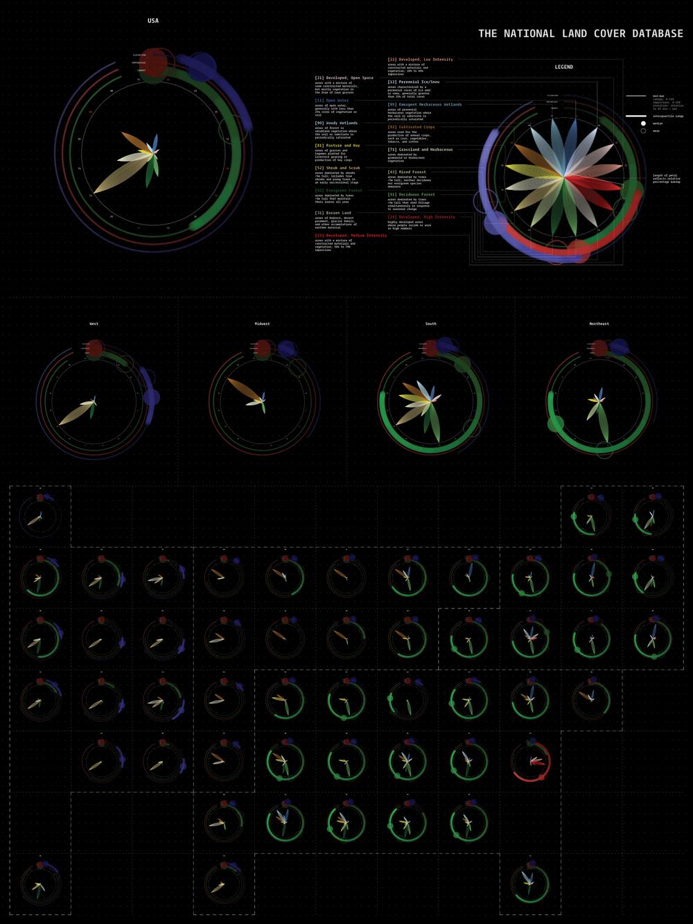
Data visualization of land cover composition across the United States; presented at three scales: national, regional, state
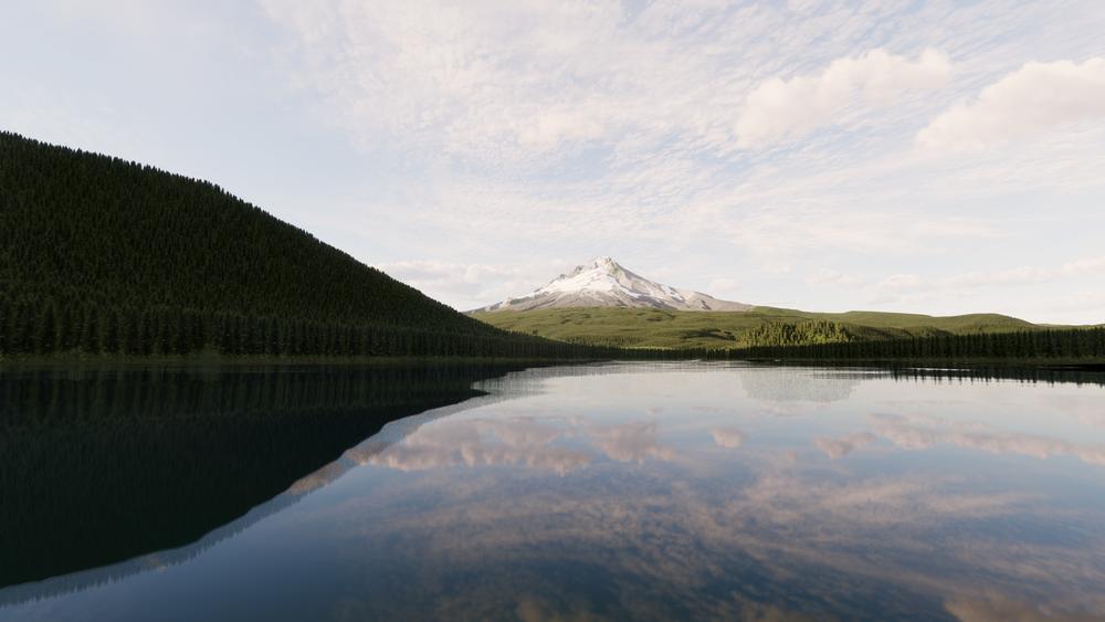
Rendering of Mt. Hood National Forest, looking north across Trillium Lake
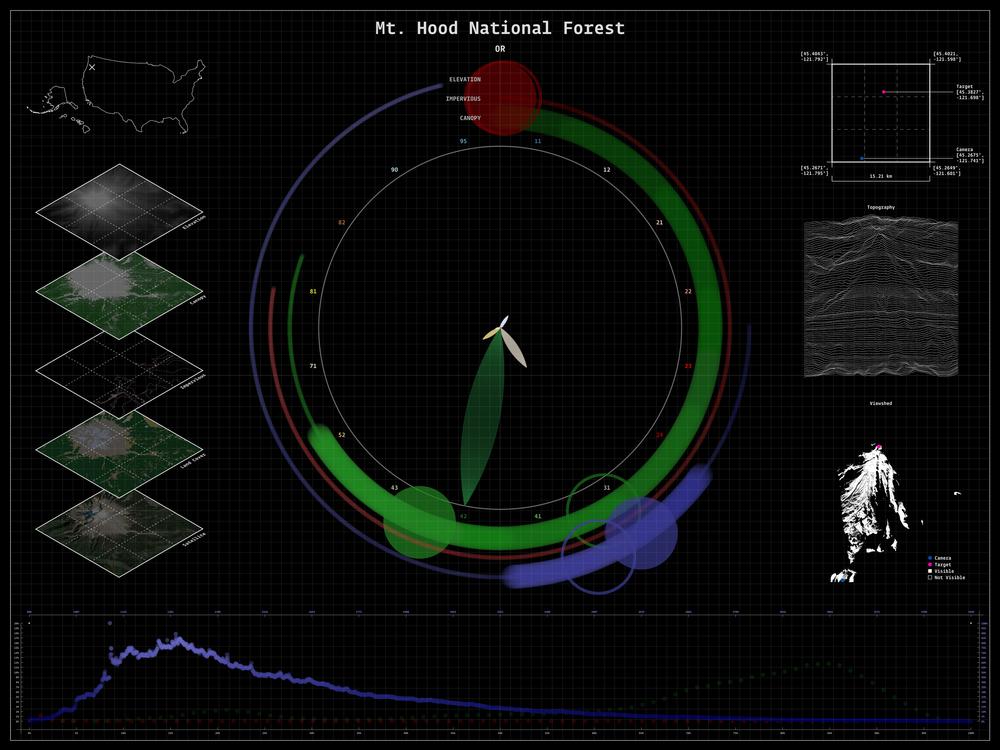
Accompanying dashboard for Mt. Hood National Forest
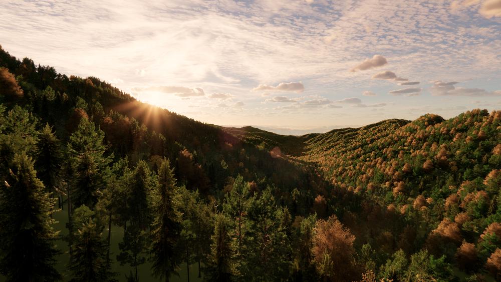
Rendering of Great Smoky Mountains National Park, looking southeast from Newfound Gap, TN
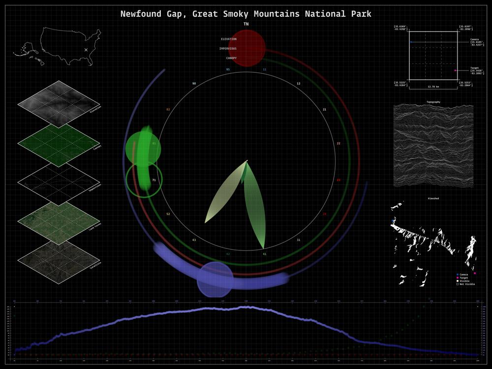
Accompanying dashboard for Great Smoky Mountains National Park
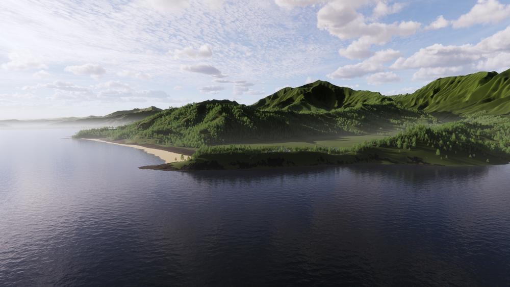
Rendering of Lumaha'i Beach, Kauai, looking east towards Hanalei Bay
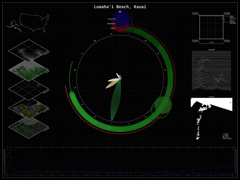
Accompanying dashboard for Lumaha'i Beach, Kauai
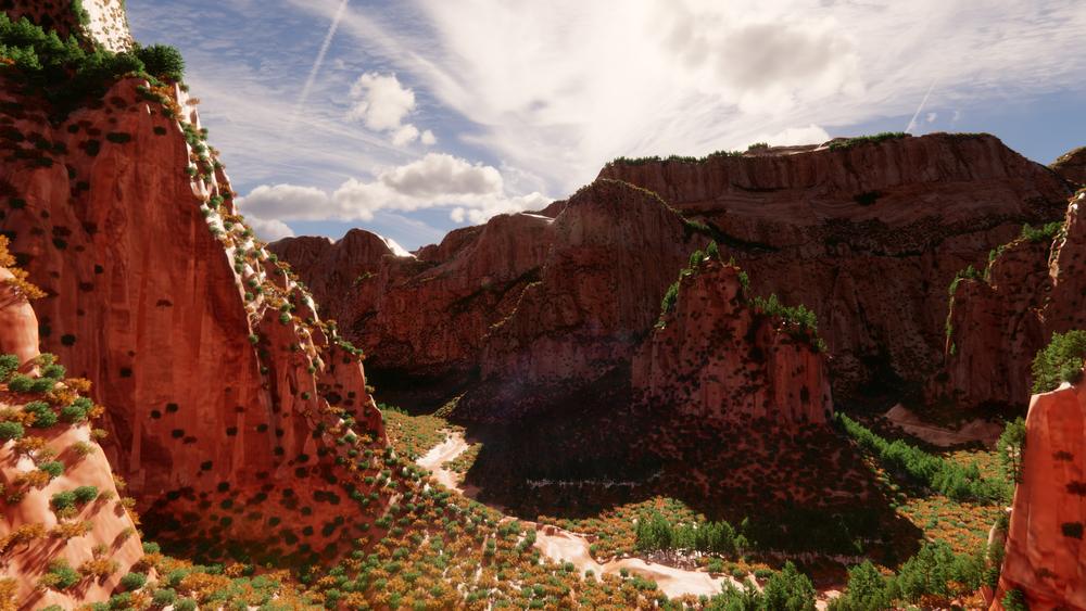
Rendering of Zion Canyon, Zion National Park, looking south toward Big Bend
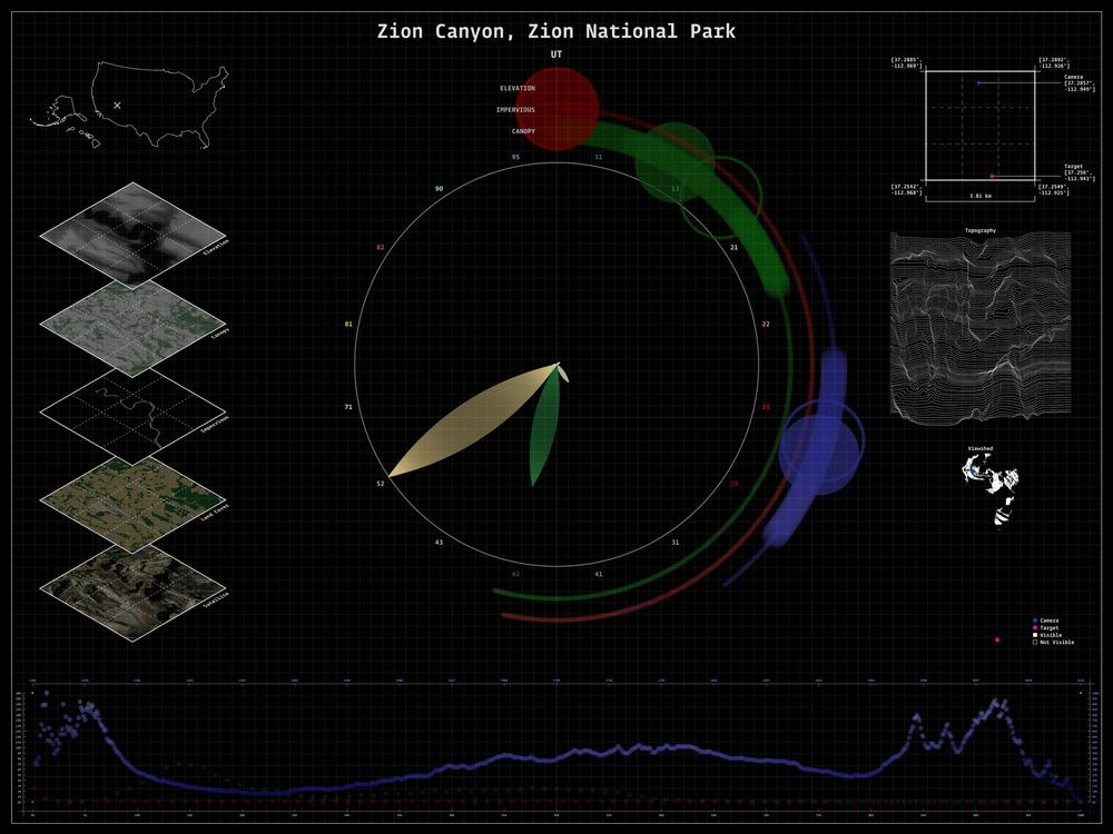
Accompanying dashboard for Zion Canyon, Zion National Park
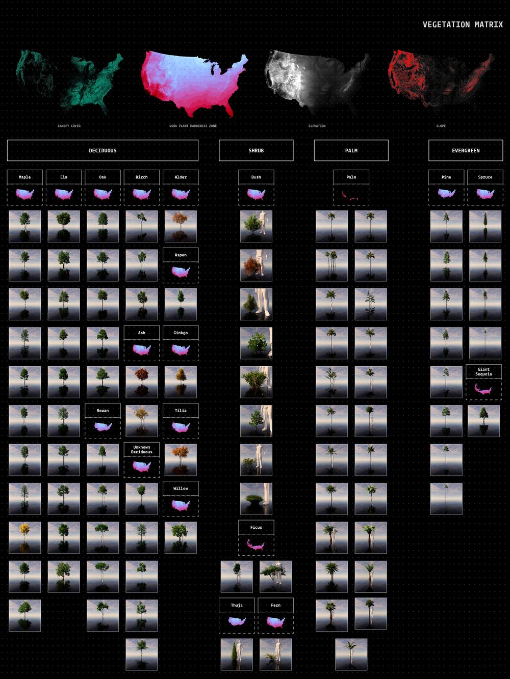
Vegetation matrix representing all possible tree inputs; a tree is selected for a specific coordinate point based on elevation, slope, and hardiness qualifications
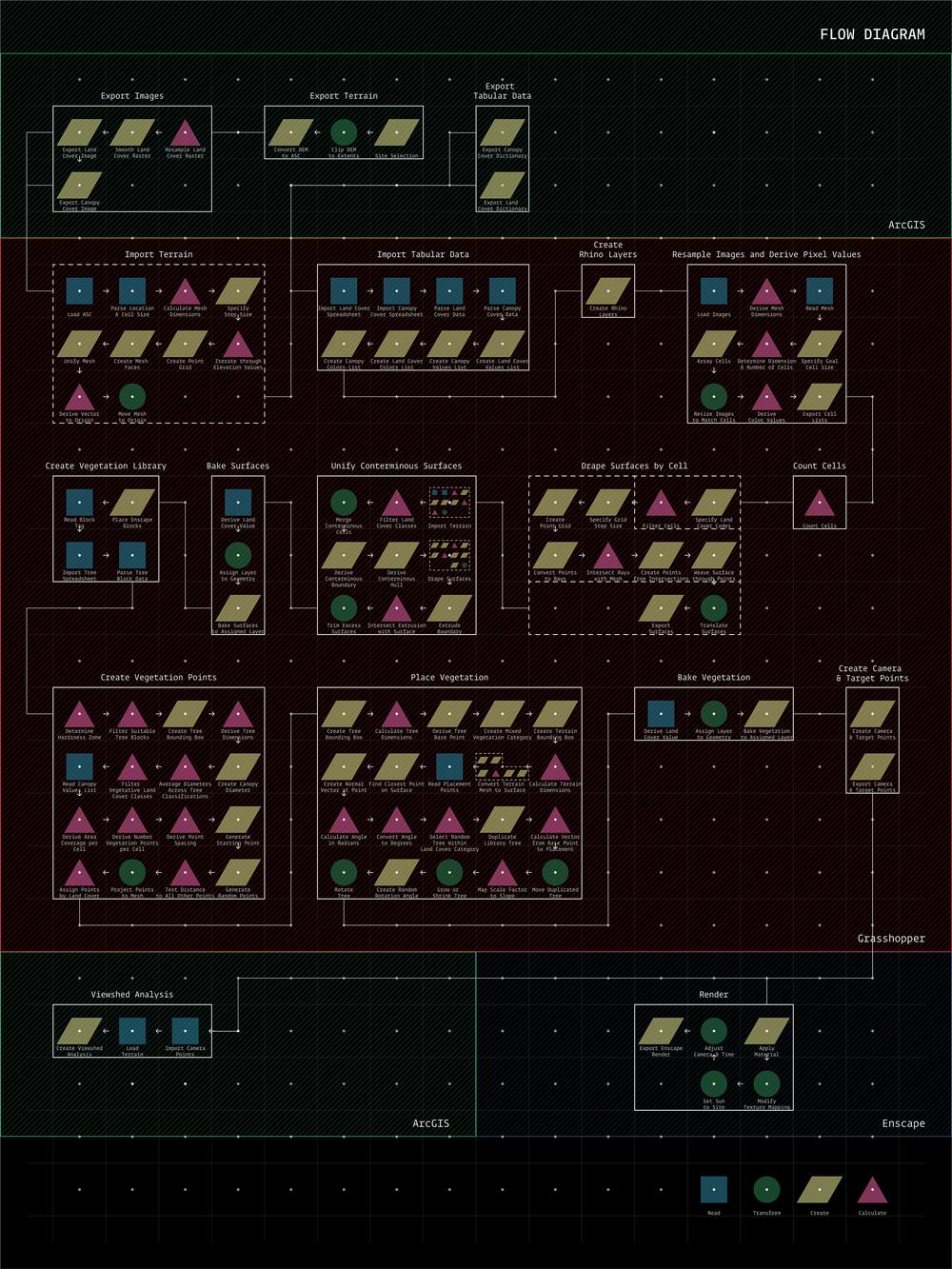
Diagram illustrating rendering workflow